Flexibility and speed of intervention

Topography by GPS/GNSS and Drone

GPS/GNSS positioning & measurements

Drone mapping

Surveying engineering – Training

Our servicesWho are we
Access a GCP’s database spread over more than

450 sites located in 90 countries and 4 continents

Calage d’images Pléiades
We work in France and abroad
Relevé GPS GNSS Toposat
Logo Toposat

TOPOSAT

Topographic surveyors and GPS / GNSS specialists

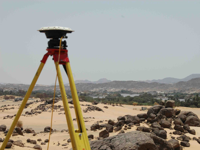
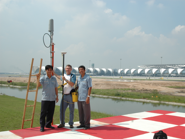
Formed in 1990 by qualified Surveying Engineer Bertrand BOULLARD – a graduate of the prestigious French ESTP school – TopoSat® provides services focusing on the use of GPS/GNSS positioning techniques.

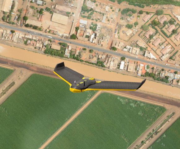
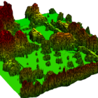
In recent years, it has completed its offer with aerial photogrammetry by Drone.

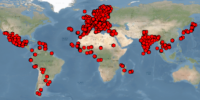
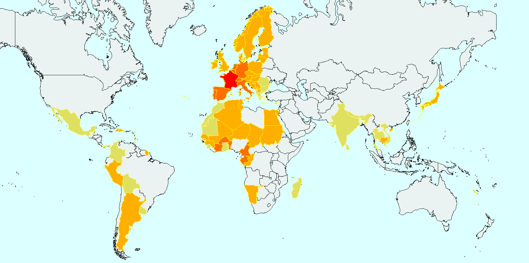
Its independent structure offers you flexibility and speed of intervention. An informal network of partners, in France and in a few other countries of the world, supports the needs requiring significant or localized human or material resources

Our servicesThe CompanyLegal
0
+
years of existence
0
+
Referenced customers

Training organization

+
0
Countries where we have worked

— Toposat —

Skills and services offered

GPS/GNSS Expertise for Topography

Our raison d’être and expertise since 1990

Ground Control Points (GCP)

GCP’s for aerial or satellite images

Lidar surfaces

Modèle Numérique d'Elévation

Topodrone

Drone mapping

Orthophotoplan – DTM – Surfaces and cubic volumes

Applications métiers - GNSS GPS - Toposat

Business Apps

Aeronautic, Agriculture, Environment & Golfs Courses,Topography and GIS, Civil Engeneering, and Mines

Surveying engineering

Drafting of tenders, Feasibility studies, Quality control, Setting and georeferencement of GNSS CORS
Formation GPS GNSS Toposat

Training

Conventional Topography, GPS for Topography and GIS, Drone photogrammetry
Relevé GPS Gabon - Toposat

GPS/GNSS Expertise

For topography and GIS, the requirement for accuracy is high and so-called “navigation” GPS is not enough. We use the following means:
  • Trimble GNSS receivers
  • Post processing software
  • RTK methods from a national CORS (Teria in France), or from our own reference station
  • Post-processed differential methods (static and PPK)
  • PPP or RTX methods

In mainland France, and in some DOM-TOM, the georeferencement in the legal systeml (RGF93 and Lambert projections, or DOM-TOM system) is quite simple, but outside these borders (even in industrialized countries for non native people) , it quickly becomes complicated. Our expertise is therefore essential and recognized.

Read moreContact Us

GCP Survey

Ground Control Point
  • Ground Control Points Survey for aerial and satellite images
  • Archive GCP Database (2400 GCP / 450 sites / 90 countries / 4 continents)
  • LIDAR reference surfaces

The production of maps from aerial or satellite images and virtual globes is not immediate. It is necessary to “rectify” and “mosaic” the original images to give them a certain geometric quality. This requires the collection of points in the field (GCP for Ground Control Point), the number and distribution of which depends on the accuray required, the processing software used and the area covered.

Read moreContact Us
relevé GPS - Soudant - Toposat
Modèle Numérique d'Elévation

TopoDrone

Reduce your costs with Drone mapping !
  • Orthophotoplan production
  • Determination of surfaces and cubic volumes.
  • Digital Terrain Models (DEM) or Elevation Models (DEM)
  • Contour line
  • Profile and cross-section.

In addition of volumes computations, we produce profiles or cross sections on request, as well as representations in different forms. We are implementing all the necessary authorizations for the use of drones, including in the city of Paris.

Read moreContact Us

Business Apps

The use of GPS can take place in several professional contexts:

  • Aeronautics
  • Agriculture
  • Environment & golf courses
  • Pipelines and other linear networkss
  • Topography & GIS
  • Civil engineering, mines and quarries
Read moreContact Us
Relevé du golf de Chantilly
Réseau GBSS-CORS du Burkina Faso. Station BF01

Surveying engineering

Any assistance service to Project Manager, company or public service
  • Scope Of Work writing for topographic works
  • Setting and georeferencement of GNSS CORS
  • Analysis of GNSS measurements accuracy

We carry out any assistance service to Project Manager or structure, company, public service in relation to topography, studies on the accuracy of devices, methods, the choice of their implementation, audits on the organization of topographic services, etc.

Read moreContact Us

Training courses

Program and duration established according to the expectations and level of participants
  • GPS/GNSS and Drone Training courses
  • Initiation and training in topography
  • WGS84, ITRF and other geodetic systems
  • Trimble TBC, Global Mapper and Pix4D software training

Used to working in various professional environments, we adapt our courses to the needs of trainees. The training programs and durations are established according to the expectations expressed and the level of the participants. The company TopoSat is registered as a training organization at the Regional Service for the Control of Professional Training in Ile de France under the number 11 92 19845 92 assigned on 03/02/2012. The internships that we organize fall within the framework of the laws on continuing vocational training.

Read moreContact Us
Formation Gabon

— They trusted us —

References

French and Foreign national bodies, local authorities, Aeronautics, Agriculture, Design and control offices, Civil Engeneering, Linear networks, Topography and photogrammetry

— List of countries, classified by continent, where we have already worked —

Geographical distribution of our interventions

The gradation of colors gives an idea of the relative frequency of our interventions.

The clearest areas (sand pattern) correspond to countries where field work has been subcontracted

and for which we have kept the calculations and quality control.

Carte globale de nos interventions

— interventions, projects, technical watch, —

Toposat News

— information, requests for topographic expertise or advice —

Contact Us

Name:
Company:
Email:
Phone:
Subject of your request:
GNSS ServicesDrone mappingTraining CoursesOther
Notes:

Phone
01 83 62 29 37 / +33 1 83 62 29 37
Skype
toposat.boullard
Postal address
Mail Boxes 112, 81 Avenue Henri Ginoux, 92120 Montrouge (France)
Linkedin
Facebook
YouTube
Twitter
Instagram