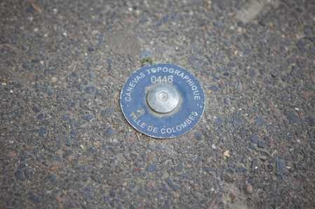
In 2012, Colombes Town Council (France) decided to set up a geodetic network (planimetric and altimetric) on its territory. As the Council did not have a topographic department, it appointed us to:
This section relates to assistance provided to contractors, project managers, firms and public services in the areas of topographic surveys, establishment of permanent GNSS stations (CORS) and geodetic networks, equipment accuracy studies, methods, implementation choices, audits relating to topographic service organisation, etc.
Each study is unique. We have chosen to show just some of the projects undertaken. If you do not find specific examples corresponding to your particular needs, please contact us so we can find you a solution.
Creation of Scope Of Work for topographic work taking into account the law relating to precision classes
The network, drawn up by the local registered surveyor who won the bid, can be viewed on the Colombes City Council website section “Cadre de vie / Urbanisme / Canevas topographique“
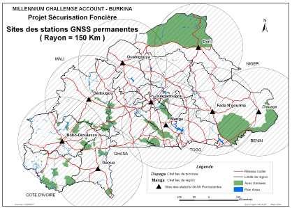
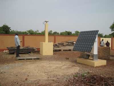
Creation of a Continous Operating Reference Stations (CORS) GNSS network in Burkina Faso
The Millenium Challenge Corporation is a structure formed in 2004 by the US Senate to provide financial aid for development.
In 2009, the Senate drew up an agreement (entitled “Compact”) with the Government of Burkina Faso aimed at financing four development areas, including the “Land Tenure Security” project. This project partially consisted of reinforcing the technical and institutional capabilities of the competent departments in terms of land management at all public sector levels.
The project gave rise to the creation of the BFCORS – a network of Continous Operating Reference Stations (CORS) in Burkina Faso.
The network was installed in conjunction with the Burkina Faso Geographic Institute and Burkina Faso Millenium Challenge Account (MCA) which is the structure set up by the MCC and Burkina Faso Government to steer the “Compact” agreement.
We were appointed by MCC to assist MCA and took part in:
We also took part in organising a National Forum on BFCORS Network Use in Ouagadougou in March 2014.
Study on dazzle incurred by the installation of solar panels adjacent to an airport
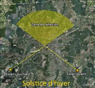
This project was located in the Montbéliard Courcelles airfield safety perimeter and the scheduled panels had a surface area greater than 500 m2; protection against potential dazzle for AFIS traffic control staff and pilots was therefore an obligation according to French directive 09/132/DSAC/ANA of June 25th, 2009.
We performed this study on the basis of a DGAC Technical Memo dated July 27th, 2011.
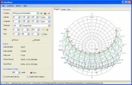
We studied the trajectory of the reflected sun rays at various times of day and year, taking into account the respective positions of the panels and their orientation, the control tower, runway protection and obstacle-free zones (OFZs) and Snell Descartes laws.
For this purpose, we used a software application describing the sun’s trajectory in space according to latitude / longitude (solar diagram).
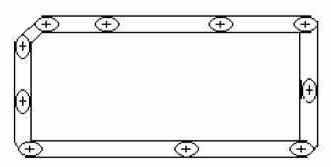
Chaque point levé participant à la définition du contour d’une parcelle est affecté d’une incertitude liée à l’instrument et à la méthode de mesure. Le point exact est en réalité situé à l’intérieur d’une ellipse d’équiprobabilité. La surface exacte (non connue) sera comprise entre celles définies par les enveloppes intérieures et extérieures à ces ellipses.
L’incertitude maximale sur la mesure de surface peut être calculée comme étant le produit du périmètre par la largeur de la bande d’incertitude (largeur égale au rayon de l’ellipse perpendiculaire au contour ou à la moitié de la distance séparant les 2 enveloppes).
Precision analysis of area measurements performed using GPS GPS/GNSS.
This study was granted to us in 1993 by the European Commission and, more precisely, by one of the Departments of Agriculture in charge of Common Agricultural Policy-related controls.
It was conducted at a time when area measurements could only be performed using differential measurements due to GPS inaccuracy at the time (Activation of Selective Availability). The analysis aimed to model measurement uncertainty obtained using first-generation code processing receivers (positioning accuracy 2 to 5 metres after correction).
The study conclusions were used as the basis for various regulations and control methods implemented at the time. Although area measurements can now be performed in natural mode, the uncertainty modelling we performed at the time is still in use.
An article (in French) published in the XYZ magazine (n°70) describes this perimeter analysis in detail.


