For more details on this service, see the online article
Aerial photogrammetry and associated products (orthophotoplans, DTM, 3D models, contour lines, etc.) are now old techniques. We trace the origin of aerial photography to the time of hot air balloons and its rise to the period of the war of 1914-1918.
Requiring an expensive implementation until recently, since requiring the use of expensive cameras with a plane or a helicopter as a vector, it was reserved for the description of large territories. Current techniques allow the production at low cost of orthophotoplans with shots taken by drone or ULM..
In a short time supply has become abundant, but it is diverse. However, an orthophotoplan or a DTM remain real “topographic documents” on which studies and costly work will be based, while topography is a very technical profession which is full of hidden traps (management of the coordinate system, use of the right model geoid, influence of linear weathering, etc.). Because these documents must provide a guarantee in terms of accuracy, because they must be enforceable against third parties, because they must sometimes be justified in front of other professionals, because the third party liability insurance which covers them is specific, it is desirable to use professional surveyors and topographers rather than multi-activity drone operators.
It is our competence, our core business, the summary of our offer.
Drone mapping of linear structure
45 km water pipeline
in Namibia
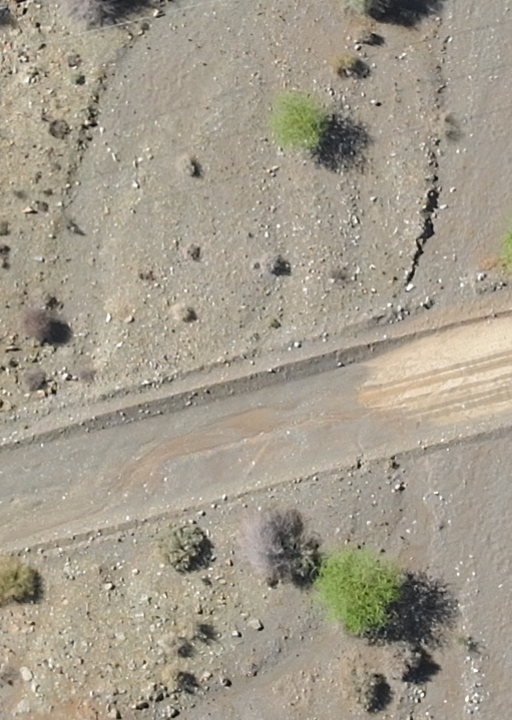
The environment was particularly favorable since we were in a desert type landscape with few shrubs as shown in the photo on left.
Drone mapping for Orthophotoplan and Data Elevation Model (DEM)
Landscaping
in the Normandy countryside.
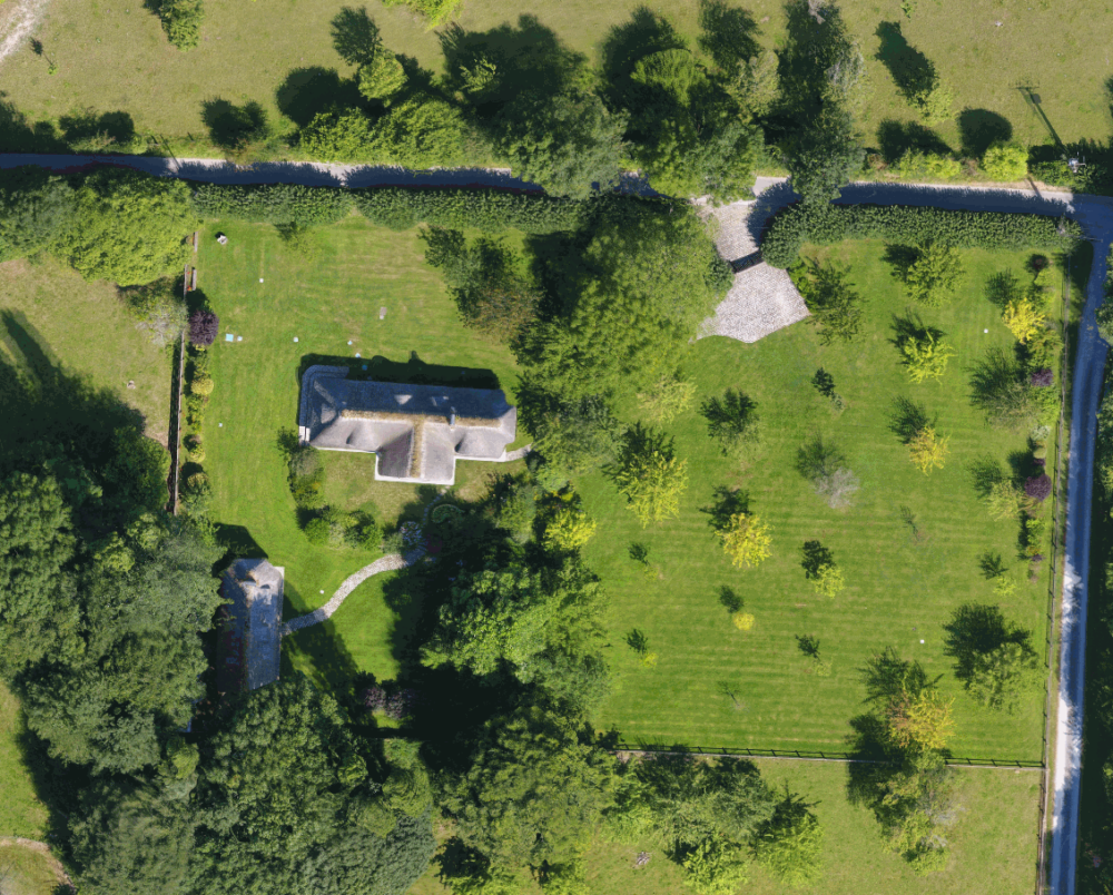
This magnificent wooded plot, in the middle of which sits a house in the purest Norman style, must be the subject of some landscaping. In order for these to fit in with the logic of the existing, we were asked to produce an orthophotoplan and to determine the height of the surrounding trees.
We carried out this work with a multicopter drone while flying at a height of 50 m to obtain images at 2.5 cm GSD. To georeference the set in the national geodetic system (Lambert 93 and NGF altitudes), we positioned targets that we surveyed with a Trimble GeoXR GPS receiving the differential corrections from the Teria network.
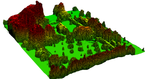
Using the same images, we were able to create a Digital Elevation Model (DEM)
By knowing the altitude of each point, we can measure the height of the trees (25 meters for those located in the southwest corner).
In another configuration, and with the same technique, we could have determined the isotopes of a pond to develop, draw the contour lines, calculate a volume of earth to move.
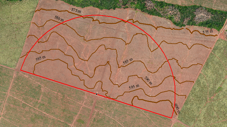
Digital Terrain Model (DTM) - contour lines - profile and cross-section.
Altimetric survey
of an agricultural plot
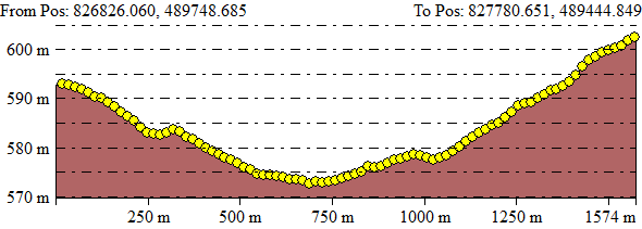
Opposite, there is an example of a longitudinal profile extraction on the path of the outer wheel of an agricultural pivot. The longitudinal profile (and if necessary the cross sections) can be provided:
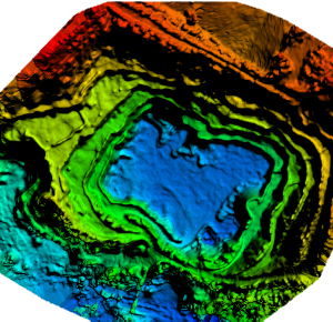
Survey of quarries and gravel pits to calculate cubatures.
Auscultation of the roof of a building in Paris
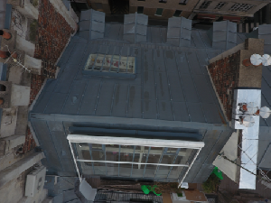
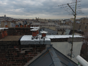
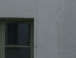
Auditing building roofs and chimney stacks is not always easy. The architect in charge of this operation on the building of which we present here some images entrusted to us a mission of shooting, which avoided the employment of a team of rope access technicians.
Working with a drone in Paris cannot be improvised. In terms of air regulations, the flight is classified in scenario S3 within the meaning of l’arrêté du 17 décembre 2015 relatif à l’utilisation de l’espace aérien par les aéronefs qui circulent sans personne à bord and the agglomeration of Paris is classified “P” (prohibited area). In addition, the place is relatively close to Hôpital Lariboisière and in the protection zone of its helicopter service.
To carry out this mission in accordance with the regulations, we had to:
This allowed us to take more than 110 photos from all angles, photos whose resolution (smallest visible detail) is less than half a millimeter. Three are presented below.
Orthophotoplans of a farm and a village in Africa
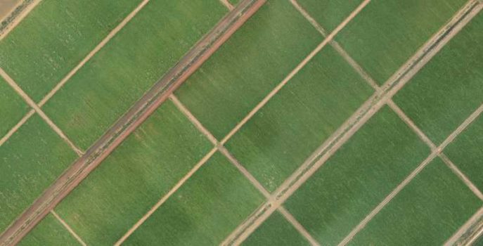
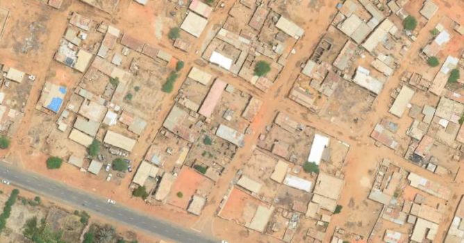
With aerial partners having light means (airplanes or ULM), we offer the production of orthophotoplans for areas too small for traditional photogrammetry and too large to involve a drone.
The following images were taken as part of a validation test of our production chain, with a ground resolution of 10 cm for the cane field and 5 cm for the village.


