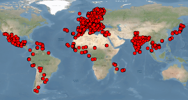
Astrium Geoinformation Services company, become an entity of the Airbus Defense and Space group under the name Airbus DS Geo SA, launched in 2012 (for execution in 2013) a global call for tenders for the collection of GCP’s for the calibration of Pléiades images on 1000 airports around the world. This program continued over the following years.
It then entrusted us with 257 of these airports (i.e. more than a quarter of its world market) which we identified with 5 regional partners (East Africa, West Africa, Mexico, Indian Peninsula, Portugal and Islands Portuguese).
We carried out field surveys on 119 of them (Asia, French Antilles and Europe) and carried out all the calculations for the 257 airports over a period of 6 months.
At the end of 2018, the total number of airports where we worked, directly or with partners, amounted to 463 in 87 countries and 4 continents.
Under the terms of our contract, we share the ownership of the raised GCPs (5 per airport, sometimes more) with Astrium and therefore have the right to resell. The coordinates of these points are delivered with a logsheet including location plan, sketch, and photos.
The list of available GCPs is available in free download (fichier kmz) with for each GCP a link allowing to see the location sketch and the photos of the surveyed point, or to download the descriptive sheet (approximate coordinates).
These points are also accessible on a interactive map.


