

The tools presented below are described in detail on our website. We invite you to access them via a link provided at the bottom of each paragraph.
TopoSat Rinex Editor

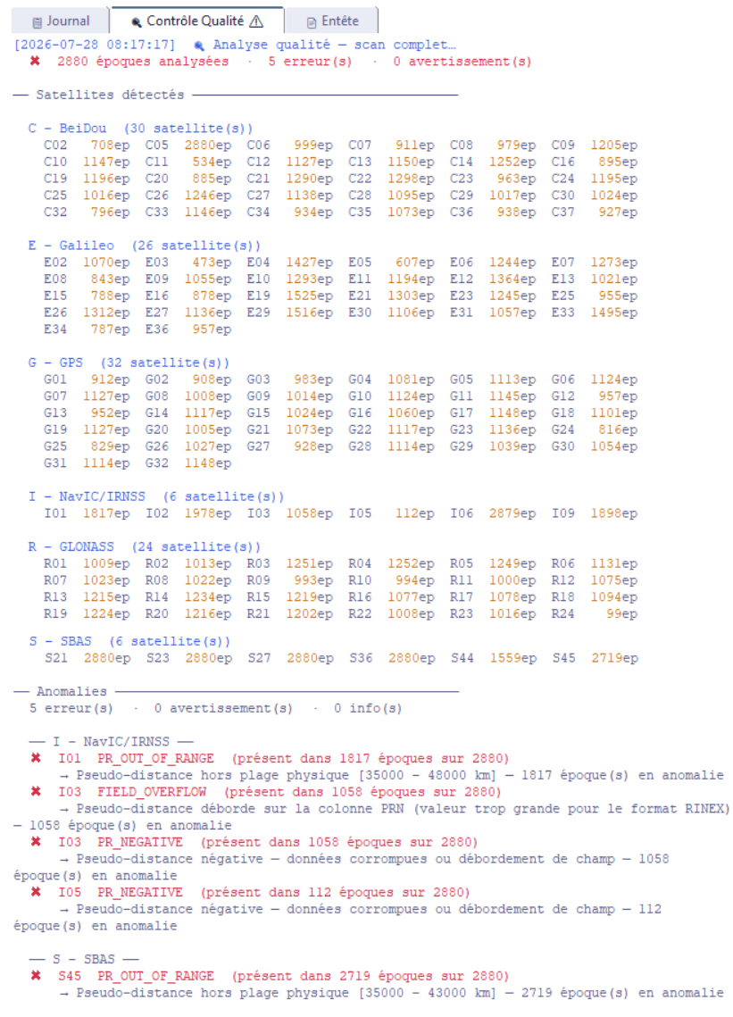
TopoSat Rinex Editor is an utility for editing RINEX files (formats 2, 3 and 4) in order to analyse the constellations present, the satellites and signals used, and to modify some of the information held in the header or the body.
It is available in English, Spanish, French and Portuguese (Europe and Brazil).
Its strengths are:
- Analysis of the source file, with a summary display of that analysis.
- Export with specific constellations, satellites or signals disabled.
- Header ECEF coordinates that can be entered from geographic or projected coordinates (with or without a geoid model).
- Reading of online processing reports: IGN France, Trimble RTX, SCRS-PPP (Canada).
- Direct conversion of ECEF coordinates into geographic or projected coordinates.
- Display of those ECEF coordinates in a KML viewer, plus KML/KMZ export.
- Conversion of a RINEX 3 or 4 file to an earlier version.
It can be used through a graphical interface or from the command line.

Access our dedicated page to discover all features and download the application.
SW Maps - a free GIS application
SW Maps is a free GIS application running on Android 4.0.3 and higher. It allows you to:
- Display a GNSS position determined by the smartphone’s internal receiver or an external receiver connected via Bluetooth or serial link using the “Mock Location” feature. This position can be displayed on either an OpenStreetMap background (default) or a Google background.
- Record GIS objects of type point, line, or polygon, associating attributes with them.
- Export data to Excel (xls/ods), Geopackage (gpkg), KMZ, CSV, GeoJSON, and SHP formats.
- Work with altitudes using most global or national geoid models.
- Use project templates for recurring operations or to share with partners. These templates can be created on a Windows PC using a free attribute dictionary editor.
- Record post-processing data in UBX format for export to RINEX format when using a GNSS receiver equipped with a u-blox chip (such as low-cost Ardusimple receivers).
Consult our summary description and simplified user guide.
LEFEBURE - an NTRIP client for receiving differential GNSS corrections
Lefebure is an NTRIP client, meaning it is software designed to receive differential GNSS corrections via the Internet from an NTRIP caster. These corrections are transmitted in the NTRIP format, which stands for Networked Transport of RTCM via Internet Protocol. While it is not the only software of its kind—others can be easily found by searching for “NTRIP client” online—it is distinguished by being free, Open Source, and easy to configure.
It is available in both Windows and Android versions.
Consult our summary description and simplified user guide.
GNSS Master - an application for controlling GNSS receivers
GNSS Master is an Android application developed by Ardusimple for controlling various external GNSS receivers from a smartphone or tablet. This application allows:
- Communication with the external GNSS receiver via USB Serial (OTG), Bluetooth, BLE, or WiFi/TCP/IP.,
- The use of any differential correction service via an integrated NTRIP client,
- The transmission of differential corrections to an NTRIP Caster,
- The use of GNSS positions (corrected or uncorrected) from the receiver with a mapping application via Mock Location,
- Simple configuration of Ardusimple receivers (base or mobile),
- Display of GNSS status (real-time constellation status).
Ardusimple offers a detailed description of all these features on its website in numerous languages.
Geoid Converter – a geoid model format converter
Consumer GNSS receivers often simply convert ellipsoidal height to altitude using a global geoid model (without necessarily specifying which one). Conversely, receivers used by professionals, or the software that complements them, allow the implementation of a national geoid model. However, it is not always easy to find the desired geoid model in the format required by our hardware or software.
The GeoidConverter conversion utility, published by EYE4SOFTWARE, is a module of the Hydromagic hydrographic calculation software developed by this company. The full software is paid, but this module can be used as Freeware.
Consult our summary description and simplified user guide, as well as the list of supported model formats.
OsmAnd – an Open Source map and navigation app
Navigation and route planning applications are numerous on the market. Most require an Internet connection to display map data for our routes, which can be difficult in certain regions.
OsmAnd is an Open Source (GPLv3) mapping and navigation (route planning) application for Android and iOS that uses maps from the OpenStreetMap project. It works offline.
Since version 4.1, it has been compatible with Android Auto. Here are several versions available:
- OsmAnd~ is the free version, available on Google Play and Apple App Store. All features are present, but the number of map downloads is limited (typically to 7 files).
- OsmAnd+ is the paid version, also available on Google Play and Apple Store. It allows you to download an unlimited number of maps and access their updates for free.
- The F-Droid version is a free software build compiled by F-Droid with almost no changes compared to the standard version. Maps are updated in the same way as in the official version, and it typically includes unlimited map downloads similar to the paid version.
See our summary description and our guide on importing GPX files.
RTKLib – a free software package for GPS/GNSS post-processing
- It is an Open Source library consisting of several programs for standard and precise GNSS calculations, particularly post-processing computations.
- It is developed and made available (free of charge) by the University of Tokyo. It can be downloaded at http://www.rtklib.com. The site states “The RTKLIB software package is distributed under the following BSD 2-clause license and additional exclusive clauses. Users are permitted to develop, produce or sell their own non-commercial or commercial products utilizing, linking or including RTKLIB as long as they comply with the license.”
See our simplified user manual and the official documentation.